Planning to do some epic hiking on Oahu? You won’t believe these 7 amazing North Shore Oahu hikes. Scroll down to see them all!
This list of North Shore Oahu hikes was written by Marcie Cheung (a Hawaii travel expert) and contains affiliate links which means if you purchase something from one of my affiliate links, I may earn a small commission that goes back into maintaining this blog.
Planning a North Shore hike off an old blog post? Don’t.
Of the seven trails people usually recommend up there, only two are fully open without some kind of catch right now, and most of the articles still telling you to go hike the rest haven’t been touched since before this year’s closures piled up.
North Shore Oahu’s main hiking trails run from Kealia and Kuaokala near Waialua to Maakua Ridge and Laie Falls near Hauula and Laie, and as of July 2026, storm damage and a few unrelated closures have knocked most of them out of commission.
Here’s what happened. Back in March, two storms rolled through one after another and tore up the trail network above Oahu’s North Shore and Waianae coast.
Farrington Highway flooded in both directions. Whole neighborhoods got evacuation orders.
Add in a separate, unexplained closure on Poamoho Trail and a years-long mess on Maakua Ridge, and you end up with a list where most of the usual recommendations just don’t apply right now.
So if you had Kealia Trail, Laie Falls, or Poamoho on your list, I need to stop you before you drive all the way out there for nothing.
Quick takeaways:
- Kealia Trail, Maakua Ridge, and Poamoho Trail are all closed. Don’t bother trying.
- Laie Falls will still give you a permit, but the trail is blocked before you reach the actual waterfall.
- Kaena Point and Kuaokala Trail are your two reliable options right now.
- Mokuleia Trail is in limbo since the access road to it is closed to vehicles.
- Trail status on Oahu changes fast. Check the morning you go, not the week before.
This is exactly the kind of mess I untangle for people in my one-on-one Hawaii travel consultations.
You tell me what you’re hoping to do, I tell you what’s possible right now instead of what some five-year-old blog post says.
What Happened to These Trails
Two Kona low storm systems hit back to back in March 2026, and the North Shore and Waianae mountains took the worst of it.
Landslides closed Kealia Trail.
The access road to Mokuleia Trail and the nearby campgrounds got washed out and is still closed to vehicles months later, with no firm date for repairs.
Laie Falls had its own landslide that’s blocked the upper trail since.
Not everything on this list is storm related, though. Poamoho Trail’s closure has no public explanation tied to it, and Maakua Ridge has been closed since spring 2025 for an entirely different reason, which I’ll get into below.
None of this is rare for Hawaii. Trails out here are split between the state, the military, and private landowners, and any one of them can shut a trail down for a year or longer without much warning.
A hike that was packed last summer can sit closed indefinitely the next.
So treat everything below as accurate right now, in July 2026, but always double check before you drive out. Hawaii’s official trail closures page and the OuterSpatial app are both good for a same-day check.
Here’s Where Things Stand on All 7 Trails
1. Kealia Trail: Closed
An 8-mile round trip near Waialua with some of the better ridge views on this side of the island, climbing through the Kuaokala Forest Reserve toward Makua Valley.
Security at the access point near Dillingham Airfield has been turning hikers away since late March, and there’s no reopening date yet.
Given how long some of these repairs have dragged on elsewhere, I wouldn’t hold your breath for this summer.
Kuaokala Trail (a few entries down) gives you a similar ridge payoff and is your closest substitute.
2. Laie Falls: You Can Get the Permit, You Just Can’t Get to the Falls
Laie Falls sits on private land owned by Hawaii Reserves, and you’ve always needed a permit to hike it.
That part hasn’t changed. It’s free, it’s online, and you’ll usually hear back within a day that your request is on file.
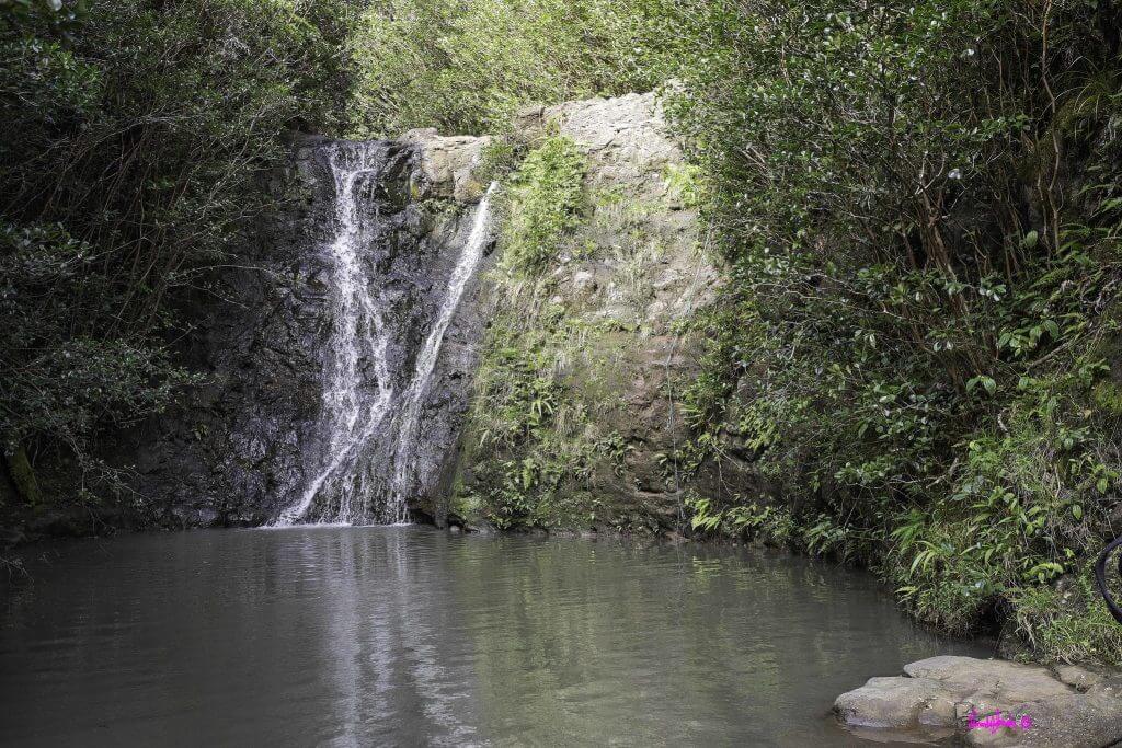
What has changed is that a landslide wrecked the trail past a stretch called the Pine Forest, and Hawaii Reserves is telling people not to go past that point.
The falls are further up the trail than that. So you can get your permit, start hiking, and still never see the waterfall.
If you’re set on the falls specifically, wait until there’s news of repairs.
If you just want a North Shore walk and don’t care about the waterfall, the section before the closure is still a nice stroll through Cook pine and guava trees.
And if you’re already in Laie for the Polynesian Cultural Center or a luau, this is a good excuse to skip the hike and save your legs for the evening show.
3. Kaena Point Trail: Open, Mostly
This is your best bet right now. A flat, coastal trail following an old railroad bed out to the very tip of Oahu, and one that’s held up well through everything that’s hit the North Shore this year.
You can start from either the Mokuleia side or the Waianae side.
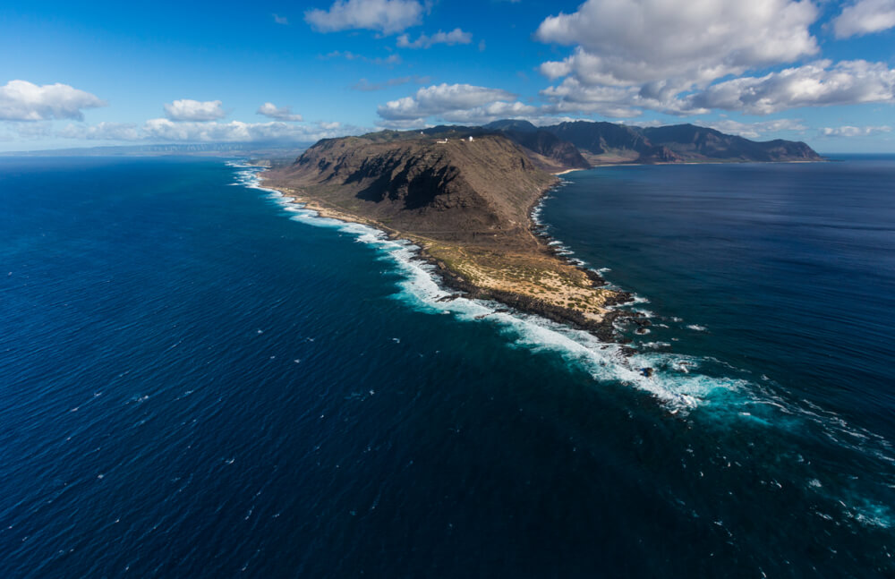
It’s about 5 miles round trip, zero shade, and a real shot at seeing monk seals, nesting seabirds, and whales if you’re there in winter.
The Mokuleia access road reopened to permit holders after the storm damage, though some side roads are still closed, so stay on the marked route.
The Waianae side has had its own closures this spring, so check before you drive that direction. And no dogs allowed since it’s a bird sanctuary.
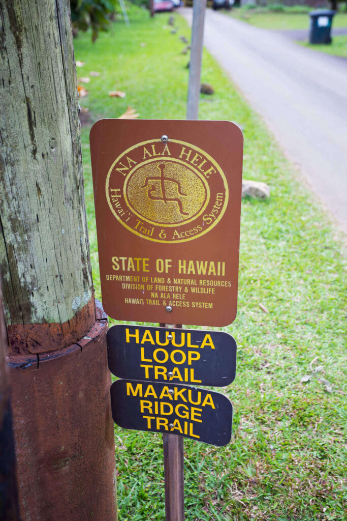
4. Maakua Ridge Trail: Closed
This is the closure that has nothing to do with the storms, or not entirely.
Maakua Ridge, near Hauula, has been shut since spring 2025, and storm damage this past March is really just pile-on at this point.
The original problem was little fire ants, found here for the first time ever in an Oahu forest reserve, and state officials said the eradication process alone could take more than a year.
Add this spring’s storm damage on top, and this trail isn’t reopening anytime soon.
It’s normally a moderate 3 to 4 mile hike with nice windward coast views, good for families since it’s not technical.
If that’s what you’re after, try Hauula Loop Trail instead. It shares a trailhead with Maakua Ridge, has stayed open through all of this, and is an easier 3-mile loop.
5. Kuaokala Trail: Open
About 5 miles round trip with 1,000 feet of climbing, ending at a ridge view over Makaha Valley and the Waianae Range.
You need a permit through Hawaii’s Division of Forestry and Wildlife, and since the trailhead sits past a military tracking station, you’ll check in at a guard shack and might get escorted to parking.
Bring ID, give yourself a few extra minutes, you’re fine.
This route did shut down for a stretch back in March when the Space Force base raised its security level, but the state’s current permit page lists it as active again with no closure notice attached.
Dogs are welcome on leash, and the trail held up fine through this year’s storms.
6. Poamoho Trail: Closed
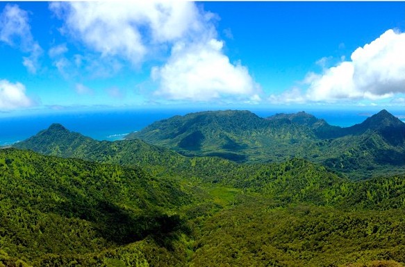
One of Oahu’s more underrated ridge hikes when it’s open, ending at a grassy lookout over Kahana and Punaluu valleys near Wahiawa.
Normally you’d need a permit to drive the 4×4 access road, with the gate only opening to permit holders on weekends and holidays.
Right now, though, the state isn’t accepting permit applications for this trail at all. I don’t have a public explanation for why, just the flat line on the official DLNR permit page saying it’s closed.
If you’d normally walk in from outside the gate without a permit, which used to be allowed, I’d skip that plan too until there’s more clarity on what’s going on here.
7. Mokuleia Trail: Complicated Right Now
A long, steady 10-mile climb with over 2,300 feet of elevation gain. Not technical, just a grind, which makes it a decent training hike if you’re working up to something bigger later in your trip.
The access road serving this trail has been closed to vehicles since March, with no reopening date in sight as of a few weeks ago.
Walking in from outside the closure adds a lot of extra mileage to an already long day, so I’d skip this one for now and check back once the road repairs move forward.
Quick Answers on North Shore Oahu Hikes
What’s the hardest hike on Oahu?
Most people say Olomana, also called Three Peaks, out in Kailua. It’s not technically North Shore, but if you’re searching for Oahu’s toughest legal hike, that’s the one.
Is the Crouching Lion hike closed?
Officially yes. The state stopped maintaining it years ago and put up closure signs, but enforcement is spotty and people hike it constantly. That’s not the same as it being safe or sanctioned, so go in knowing nobody’s watching out for you if something goes wrong.
Why is the Stairway to Heaven trail closed?
It’s been closed since 1987, which surprises most people. The current drama is over whether the city tears the stairs down for good. Honolulu’s city council voted to remove them, preservation groups sued to stop it, and the whole thing is still tied up in court. Either way, hiking it is illegal, fines are real, and it makes life miserable for the neighbors who live around the access points.
Do North Shore hikes require a permit?
Several do, yes, including Laie Falls and Kuaokala Trail, either from Hawaii Reserves or the state’s Division of Forestry and Wildlife. Poamoho Trail normally requires one too, though the state isn’t issuing permits for it at all right now since the trail is closed. Apply ahead of time for any trail that needs one. Don’t assume you can show up and start walking.
Before You Go
Bring more water than you think you’ll need. Almost none of these trails have shade. Check trail status the morning of, not the week before, since things change fast out here.
And if you’re renting a car for the trip, Discount Hawaii Car Rental is who I send people to, since you’ll need your own wheels to reach most of these trailheads anyway.
If you’d rather hand off the “which trail is open” research to someone else, that’s a normal thing to ask for help with.
I build realistic Hawaii itineraries for people who’d rather spend their vacation hiking than fact-checking blog posts.
And if hiking ends up being a smaller part of your North Shore day than you planned, there’s still plenty to do out there.
My Oahu travel guide covers food, beaches, and the rest of the island in more depth.
Things will reopen eventually. They usually do. For now, stick to what’s open, and you’ll still have a great day out there.
 | About the author: Marcie Cheung is a Hawaii travel expert who has visited Hawaii more than 40 times. She is the founder of Hawaii Travel Spot and host of Hawaii Travel Made Easy. She plans Hawaii vacations for couples, honeymooners, families, and other travelers. |